
Uluru Location Information
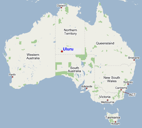
Map of Australia
Geographically located near the centre of Australia, Uluru (formely Ayers Rock) has its own airport and can be accessed by road and /or air. Rail access is to Alice Springs only
Distances (direct flight NOT Road) and flight times from the main capital cities are listed below .Please Note: Not all flights from the Capital Cities fly directly to Uluru. Travel may require you to travel via Alice Spring
| Uluru to | Distance (km/miles) | time |
| Adelaide | 1290km / 802 ml | 1h 40min |
| Perth | 1650km / 1031 ml | 2h 12min |
| Darwin | 1500km / 937 ml | 1h 59min |
| Brisbane | 2203km / 1345 ml | 2h 45min |
| Sydney | 2165km / 1369 ml | 2h 45min |
| Melbourne | 1903km / 1182 ml | 2h 28min |
| Alice Springs | 335km / 208 ml | 40min |
Map of Red Centre
If choosing to visit Uluru you can fly in directly to Uluru (Ayers Rock Airport) or fly into Alice Springs and drive the 460 km (5hrs) or catch a coach (6hrs) to Uluru.
Other things in the Red Centre
There are a number of notable attractions between Uluru and Alice Springs worth exploring (notably Kings Canyon and the West MacDonnell Ranges)
A popular itinerary for people who want to spend the extra time exploring around the Red Centre is to fly into Alice Springs and out of Uluru or Vice Versa
If planning to explore the Red Centre a minimum of 6 days is recommended.
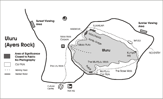
Map of Uluru (Ayers Rock)
Distance between Uluru and Ayers Rock Resort is 18km (20mins by road one way)
Distance between Ayers Rock Airport and Ayers Rock Resort is 6 km (10min)
To make a Reservation call 1300 559 390
(within Australia) or email us info@uluru.com
Terms & Conditions